Bloomfield, VT to Groveton, NH
We’re back! After my last trip, my friend Tom reached out to me asking if he could join me on my paddle. Unfortunately I was already done that leg, but I told him we should to a few days section later in the summer. So here we are!
We chose to do these 2 sections over the course of 3 days. The first section is Bloomfield, VT to Groveton, NH, was billed as 22 miles of down river with no portages! And being within easy driving distance to us seemed like a great pick.
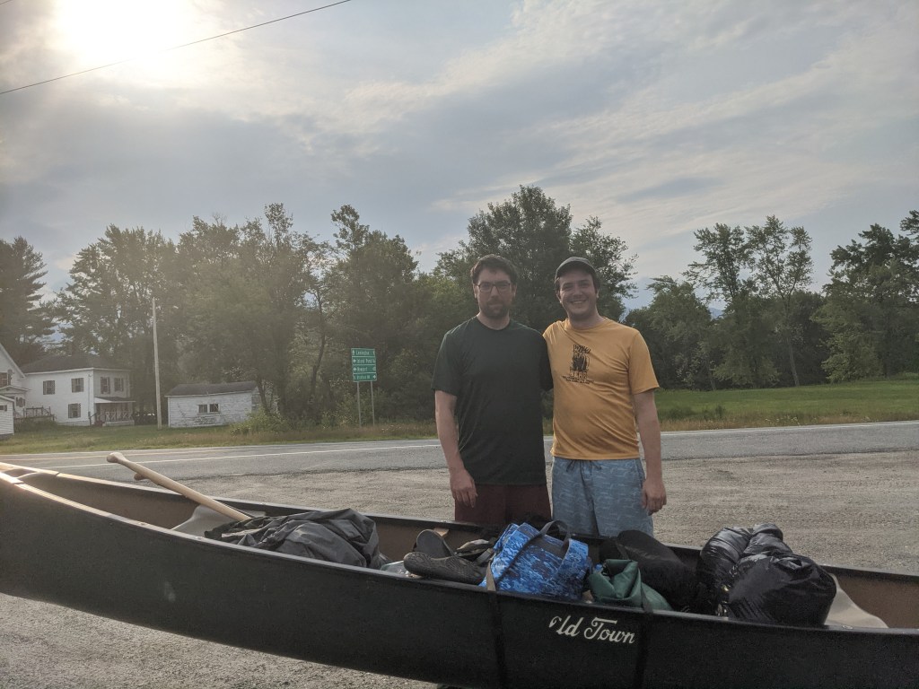
Last night after work we convened at Tom’s house and made way for Gord’s Corner Store in West Milan, NH. The drive on Route 16 past North Conway to Gorham, NH was beautiful with the setting sun. Gord’s Corner Store will be our end point and Janet, a proprietor of the store, told us for a fee we could leave a car there and camp out. So this is what we did.
After grabbing a coffee and squaring up with Janet we hit the road around 7 to drive Bloomfield which was a little over 30 minutes drive. Here we left Tom’s truck, and loaded our stuff up where the Nulhegan meets the Connecticut.
I must have seen the Connecticut in passing at least driving through Springfield, MA, or maybe some part of the synonymous state but I guess I’m not positive sitting here. In any case, the river I was picturing was wider and deeper than what we were on (granted we’re closer to the headwaters but nevertheless). It was narrower and far shallower than I expected, rocky with some minor rips to start the day out.
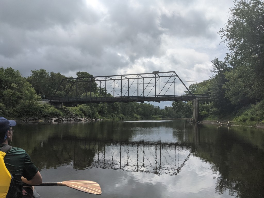
We got poured on a intermittently to start but enjoyed the cool drizzle for first couple hours. We watched ospreys hovering above the river searching for fish, before soaring out of sight beyond the treeline of silver maples shimmering in the breeze. Mergansers and Canadian geese both in large groups were not uncommon sights. The river was twisting with one bank often high in a natural berm littered with grasses, mullein, milkweed, goldenrod, and wild potato flowers; the opposite bank a sandy beach leading to a maple and oak forest.
With relative ease we made it to the Ammonoosuc and turned upstream. The last two miles were the most challenging of our day. The river is woefully shallow but the current can be strong, such that a strong deep paddle stroke can’t be made without hitting river bottom; making forward momentum hard to find. Often Tom and I would just hop out and wade the boat past the rips to paddle a little ways and get out again.
Finally we made it to Normandeau campsite around 5 or so. Though riddled with mosquitoes the site has good ground for a tent, a boat washing station, picnic table, and a privy.
After setting up camp and eating. We decided to walk to town to top off our water to be safe, and grab some soap for utensils which I must have left right on my living room floor. We were hoping for a beer too but apparently the closest bar is in Lancaster. Tom treated me to a slice of pizza though.
The next section from here to West Milan is 19 miles, but because it’s upstream and several boulder fields it is considered a challenging stretch. As such we plan to do it in 2 days instead of my customary 20 miles per day. The goal is to get to Frizzell Campsite outside of the town of Stark tomorrow, and then evaluate how we feel. There aren’t many camping options so it’s either 7.5 miles or 15 miles tomorrow. We’ll see. Hopefully I have service for an update tomorrow. Cheers!

hey Josh ! thanks for the great update and the pics ….. again , it’s like we’re “in” on the gig !!! hi to Tom !!! ENJOY !!!
LikeLike