Driving and Finishing Vermont
I debated writing about this bit but it does give some context for the meat and potatoes of this chapter. In my last post, I mentioned how I was picked up before truly finishing the last four miles of walking to Bloomfield. I planned on finishing this and the West Milan to Errol, New Hampshire leg of the trip I’ve been meaning to do since 2021. I took half a day off of work and intended to drive to VT, finish the portage, then make my way back to NH and stage myself for a long day to hopefully complete the arduous 23 miles upstream to finish the penultimate state.
I had been in the area a few times now and thought I had a plan ready to go. I would camp at Northern Waters Outfitters right along the trail, and use their shuttle services to pick me up or drop me off. I had stayed here back in 2021 when I did the Rangley Lakes region. Alternatively, I would stay at Gord’s Corner Store and arrange a shuttle some other way, which I had done in July of 2021 with Tom.
Well things can change in three years. Gord’s is now Ray’s, and I was told after being passed on the phone to three different people that there is no Ray; I guess the key to a successful corner store is to name it after a suitably provincial sounding moniker whether or not that person exists. Northern Waters Outfitters was closed for the season and the man on the phone was more interested in telling me about the alleged golden eagle that he had seen (I’m skeptical but I digress). His final advice was to hitch hike with my paddle and I should have no issues getting a ride.
I hadn’t done much planning or packing for this trip as I intended to only be gone for the night and figured a smaller pack with the bare minimum supplies would do me fine. The result was I realized as I was packing the car that I only had one half of my kayak paddle, other half was in my parents car from when they picked me up last trip… So an old fashion canoe paddle would have to do.
I drove to Errol and checked in at Akers Pond Inn Cabins and Camp Sites, before bombing onward to Bloomfield. I had just enough daylight left with all the driving to finish the portage before dark. I passed the stately but abandoned Balsams Hotel nestled among the wilderness. Eventually I pulled over on the side of the road near where I had been picked a few weeks before, and locked my canoe and wheels to a telephone pole, before driving back to Bloomfield to park the car.
There’s not much to be said hereafter, I walked about thirty minutes before being picked up by a couple from Quebec who were confused about where my canoe was and how I was walking back. And an hour and a half later as the sun was setting I made it to my car and signed my name in the NFCT kiosk, which was filled with drowsy hornets. And with that anticlimactic moment I had finished all of Vermont! Unfortunately I forgot my GPS while I did this, hopefully that doesn’t come back to bite me when I register as having completed the trail.
West Milan to Errol… Almost
The drive back to Errol was well and truly dark. I had planned on waking up at 4:30 AM to give myself plenty of time to finish the day, and the early darkness made going to bed rather easy. I set up my bivy bag next to my car and hunkered in my 20 degree sleeping bag. I was surprised to find I was comfortable all night long, but the condensation in the bivy had really soaked the larger sleeping bag as there was no airspace in the bivy. Luckily I brought my other sleeping bag in case I needed to camp out another night, so I didn’t need to pack the bag away wet.
It was extremely foggy in the morning (which didn’t help the condensation. And it made driving a hazardous affair. Luckily there weren’t many other cars out and about. The speed limit was 50 or 55 but I was doing 35 because of the lack of visibility. All in all it made the drive to West Milan slower and I wasn’t strapped up and on the go until 6:30.
I say strapped up, because of course this section starts with a 3.5+ miles of portaging between the Ammonoosuc and Androscoggin Rivers. For those that are interested, all of the water bodies of water from Old Forge to Island Pond all ultimately drain into the St. Lawrence waterway, the Nulhegan and Ammo are part of the Connecticut River watershed, after that, except for the Allagash, everything drains into the Androscoggin and Kennebec rivers which meet in Merrymeeting Bay north of Bath. So this portage marked the crossing into one of the four major watersheds of the NFCT.
I was nervous about walking in the dark early morning and the fog added to my anxiety, but by 7 it was suitably light enough that I wasn’t worried. There was one good uphill that got my heart pounding but after that the road was more or less level and not too difficult. My wheels are nearing the end of their life though and despite greasing up before each use they are starting to drag a little.
By 8:30 I was at the Pontook Dam Reservoir, and wasted no time getting in the water. I had worked up a sweat on the uphills but had gotten chilly as soon as the going got easier and I put on my fleece. The weather report I saw said it was supposed to be in the 60s and sunny. I knew I had to trudge up some rapids and was nervous about it as I was cold without being wet and in the water. But the first 5 miles or so above the dam were flat water with little noticeable current. I was surprised to find the canoe paddle wasn’t much slower than the kayak paddle but I had to switch from left to right every other stroke which takes more concentration.

It was quiet in the fog, some ducks could be seen flying by, one bald eagle in a dead tree was ruffled out and staying warm. Occasionally the sound of traffic from the adjacent route 16 could be heard. Some of the flat water sections had homes by the banks with docks and boats.
Around 10 or so I started hitting the current. Most of it wasn’t much and I could paddle or push my way along without getting out or hitting rocks if slowly. Eventually though I got to part where getting out was the wiser option. I was worried not only of the cold but the depth of the river. The water was dark and with no direct sunlight I couldn’t gauge the depth and my impression was hip deep, and there wasn’t much of a bank to walk along. But my first outing proved my fear unfounded and I kept the water below my knees.
The first stretch of rapids was about a mile and a half, and it slowed me down dishearteningly so. My pace during the portage and first mile or so of paddling was about 3 miles per hour, which led me to believe I could be in Errol by 3 or 4! I should have known better. The next I checked the GPS my moving average was down to 2.5 mph, which would only drop as the day went on.
I got past the first set of rapids to another flat water section, and around 11 seemingly out of nowhere the sun was out and the fog was lifted and I took off my fleece. This section was beautiful with the bright sun and the red and gold leaves reflected on the still waters. The traffic picked up now, with many motorcycles going by for joy rides.
Soon I got to Seven Islands Bridge, part of the ATV trails. The current here was strong and I had to ferry around to find the right line. Eventually I hopped onto the pylons and pulled my canoe under the bridge. I had an audience and luckily didn’t make a fool of myself. Not far past here, I passed a group of paddlers coming downstream while in some small rips. Some of the weekend warriors looked white knuckled terrified, and I weaved around them while trying to talk to the guides about water conditions upstream. I was hoping I was nearly out of the next stretch of rapids and had smooth paddling to Errol.
Unfortunately this didn’t seem to be the case. And I fought my way up stream. I got to some rapids where I had to jump out, but as I started walking I was suddenly belly deep and struggling to keep my footing. I slowly went back downstream until I could find a path to the shallows. Disaster averted. I passed an onlooker who I assume was fly-fishing. The rapids here were tough without getting out but I didn’t want to risk hopping out only to find it too deep again. I came around the next bend and could only see rapids ahead. I checked my GPS, and I had about 7 miles until Errol. I guestimated it would take me 3 to 3.5 hours to reach my destination. It was 2 PM, plenty of time before dark but I had to get back to my car some 20 miles down the road. Optimistically that would take me 7 hours of walking if no one picked me up hitch hiking. I didn’t relish the idea of walking and hitching in the dark.
I decided that I’d rather start walking with daylight and besides I had already come 17 miles and gotten the portage out of the way, I could come back another day to finish this another time. I went downstream and found a likely path up to the road and dragged my stuff up into the grass on the side of the highway. I swapped my water shoes for my hiking boots, grabbed my backpack and paddle, and started down the road.
A word on hitch hiking: it’s disheartening when a car goes by and you hear them rev the engine up to go by you faster as if they’re making it known they want to leave you in the dust. And several times I’d turn around only to find it was a motorcycle coming up behind me, which I didn’t want to attempt. The first few failures I was sputtering to myself about the guy who told me I’d have no problem getting a ride. “Sure no problem, really friendly people here” I’d say with an eye roll as I was eating the dust from some big Ram truck with a roaring engine.
Eventually a truck did pull over and asked where I was going. His name was Bob, with a great big curling mustache, he looked like someone who would run a train engine at a heritage day fair. He asked where I was going and he was going the same way as me. He knew some about the trail as he had offered rides before. And told me about an orienteering race that had been held in the area, and told me about the plans for restoring the Balsams Hotel. Bob is a woodworking artist (he made the trophies for the orienteering race) and told me about a cedar strip canoe he had made too. Thirty minutes or so and we were at my car; the miracle of internal combustion had saved me 6 hours! I said farewell and we parted ways.
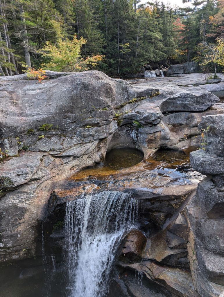
I will say I did consider getting back in the canoe after I drove back up the road as now my car was closer and I would only need to walk 7 miles back to my car instead of 20+, but I decided I wanted to get home at a decent hour and I had lost the gumption. It gave me time to stop at Screw Auger Falls on my way back!
That’s it for this trip! I’m hoping to go back to finish New Hampshire this year but no promises as we get into October and it gets chillier. So long for now!

way to go Josh !!! Vermont , ✔️ … New Hampshire , you’re next !!!
thanks for sharing !!!
love ya ,
Auntie Stella
LikeLike